
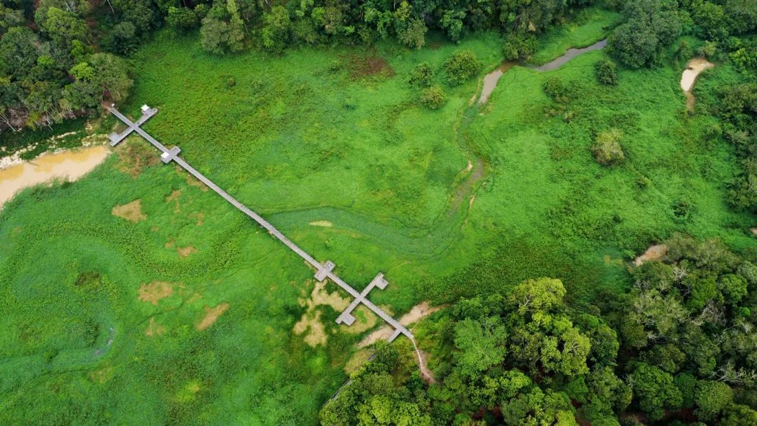
The picturesque expanse of Waduk Manggar, a vital 500-hectare reservoir located in the thriving tourism hub of Kawasan Wisata Meranti, Balikpapan, East Kalimantan, has become the epicenter of a growing environmental crisis following an aggressive infestation of invasive weeds and wild aquatic plants that now choke its waters and severely disrupt local livelihoods, agricultural irrigation, and regional water supplies.
Captured in striking aerial photography that reveals a sprawling blanket of green biomass smothering the once-open waters, the unfolding situation at the reservoir—documented on Wednesday, September 16, 2026—has triggered alarm bells among local communities, tourism operators, and environmental observers. What began as an unchecked botanical proliferation has swiftly escalated into a multi-faceted emergency, threatening the socio-economic fabric of the surrounding areas while underscoring the delicate balance required to manage tropical water infrastructure amidst shifting ecological pressures.
The Scope of the Infestation and Immediate Impacts
The primary and most immediate casualty of the weed invasion has been the local tourism sector. Waduk Manggar has long served as a recreational magnet, drawing visitors to the Kawasan Wisata Meranti for leisure activities, notably boat tours that offer scenic vistas of the massive water body. However, the relentless spread of dense vegetation has formed impenetrable mats across the surface of the 500-hectare reservoir.

For the boat operators and local vendors who depend on weekend and daily visitors for their income, the impact has been catastrophic. Traditional wooden and motorized watercraft can no longer navigate the choked channels. The physical barrier created by the thick layers of weeds effectively halts all recreational boating, cutting off the lifeblood of community-based tourism in the area. Local families who rely on tourist spending are now facing steep drops in household revenue, compounding financial anxieties in a post-pandemic economic landscape.
Beyond the tourism sector, the ecological repercussions extend deeply into the region’s agricultural and municipal infrastructure. The accumulation of massive organic matter accelerates the natural process of reservoir sedimentation and siltation, leading to premature shallowing of the basin. More critically, the dense vegetative cover threatens the reservoir’s primary engineering purpose: supplying raw water for regional needs and agricultural irrigation channels. As the aquatic weeds consume oxygen, alter water quality, and displace water volume, agricultural stakeholders in downstream regions face looming shortages that could jeopardize upcoming crop yields.
Background Context and Environmental Dynamics
To understand the current crisis at Waduk Manggar, one must examine the complex interplay of tropical hydrology, nutrient loading, and infrastructure maintenance. Reservoirs situated in tropical zones like East Kalimantan are inherently susceptible to rapid biological growth. High ambient temperatures, abundant sunlight, and agricultural or urban runoff rich in nitrogen and phosphorus create ideal conditions for invasive aquatic weeds—such as water hyacinth (Eichhornia crassipes) and similar aggressive macrophytes—to proliferate exponentially.
Waduk Manggar is not merely a recreational destination; it is a critical hydrological asset for the municipality of Balikpapan and its environs. Constructed to harness regional rainfall and manage water distribution, the reservoir acts as a strategic buffer against seasonal droughts, which frequently afflict parts of East Kalimantan due to climate variability and the overarching geographical shifts linked to regional development.
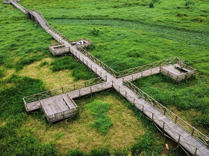
Over recent years, expanding human settlements, localized land-use changes, and agricultural activities within the upstream watershed have increased the influx of nutrient-laden sediments into the reservoir. This nutrient enrichment, or eutrophication, acts as an invisible fertilizer, fueling the rapid expansion of weeds that authorities are now struggling to contain. Without aggressive mechanical harvesting, stringent watershed management, and continuous dredging, reservoirs of this scale can experience irreversible ecological degradation, shifting from open-water systems to shallow, marshy swamplands.
Chronology of the Crisis
While the dense infestation reached a highly visible tipping point by mid-September 2026, environmental experts note that the problem is the culmination of months, if not years, of gradual biological accumulation.
The timeline of the current escalation highlights a systemic vulnerability in rapid-response environmental management:
- Early Phase (Late 2025 – Early 2026): Monsoonal rains wash increased loads of agricultural runoff and organic debris into the tributaries feeding Waduk Manggar, setting the stage for accelerated plant growth.
- Mid-Year Acceleration (April – June 2026): Amidst shifting weather patterns and stable water temperatures, patches of invasive weeds begin to multiply unchecked in sheltered bays and shallow zones of the 500-hectare reservoir.
- The Tipping Point (July – August 2026): The weeds coalesce into expansive floating islands. Local boat operators report increasing difficulty steering through specific corridors of the Kawasan Wisata Meranti.
- Full Crisis Realization (September 16, 2026): Aerial documentation captures the full extent of the disaster. The reservoir’s surface is overwhelmingly obscured by vegetation, halting tourism entirely, accelerating siltation, and raising formal alarms regarding irrigation water security.
Socio-Economic and Municipal Implications
The crisis at Waduk Manggar serves as a cautionary case study for regional resource management, particularly as East Kalimantan undergoes rapid demographic and infrastructural transformation driven by regional development initiatives. The dual failure of the reservoir—simultaneously paralyzing local tourism economies and threatening agricultural water supply—highlights the vulnerability of engineered ecosystems when maintenance lags behind ecological changes.
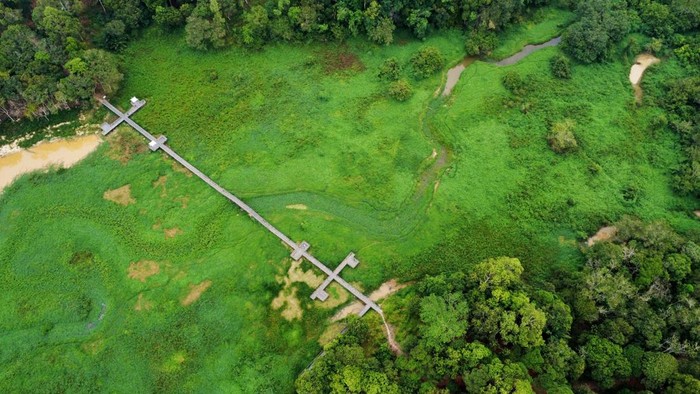
Local community representatives and tourism cooperatives have voiced deep concerns over the prolonged timeline required to restore the reservoir to a functional state. Manual removal of the weeds is rendered impractical by the sheer scale of the 500-hectare surface area, necessitating heavy machinery, specialized aquatic weed harvester vessels, and sustained financial intervention from regional and provincial governments.
Furthermore, the implications for water resource management are profound. Balikpapan relies heavily on stable raw water reservoirs to sustain its growing urban population and industrial zones. Any reduction in effective water storage capacity caused by siltation and weed proliferation directly translates to a heightened risk of water rationing during prolonged dry spells. Agricultural sectors dependent on the reservoir’s irrigation channels face similar existential threats; even a temporary disruption in water delivery can ruin seasonal harvests, threatening local food security and rural incomes.
Path Forward and Mitigation Strategies
Addressing the crisis at Waduk Manggar requires a comprehensive, multi-phase remediation strategy that moves beyond short-term cosmetic cleanups. Experts emphasize that sustainable recovery demands a combination of immediate mechanical intervention, long-term watershed management, and community engagement.
- Immediate Mechanical Harvesting: Deploying specialized aquatic weed harvesters to systematically clear the water surface, prioritizing navigation channels for tourism operators and intake points for agricultural irrigation.
- Dredging and Silt Removal: Addressing the underlying issue of reservoir shallowing by implementing targeted dredging operations to restore original water depth and storage capacity.
- Upstream Watershed Management: Mitigating nutrient runoff at the source by regulating agricultural fertilizer usage, implementing riparian buffer zones along feeder rivers, and controlling urban waste influx.
- Stakeholder Collaboration: Establishing a joint task force comprising regional government agencies, tourism cooperatives, environmental watchdogs, and agricultural representatives to ensure continuous monitoring and maintenance of the reservoir.
As the stakeholders in Balikpapan grapple with the fallout of the September 2026 weed infestation, the situation at Waduk Manggar stands as a stark reminder of the vigilance required to protect vital natural and man-made resources. Balancing the recreational value, economic necessities, and ecological health of such a massive water body will remain a critical test for regional authorities in the years ahead.


