

The emergence of an arid, cracked landscape resembling a desert in Biku Sarana Village, Jelai Hulu Subdistrict, Ketapang Regency, West Kalimantan, has captured public attention and sparked discussions across national social media platforms. What was once recorded as a water-filled waterbody—specifically a former mining excavation pit—has dramatically transformed into a parched expanse featuring deep fissures and barren terrain. This striking transformation, documented and widely shared by a TikTok user identified as Tyaaaaaaaaa243, offers a stark visual representation of environmental shifts occurring within artificial aquatic ecosystems in the region. While colloquially dubbed a new "sand desert" by internet users, the phenomenon highlights complex interactions between post-mining land-use legacies, artificial hydrological systems, and regional climate variability.
Main Facts of the Transformation
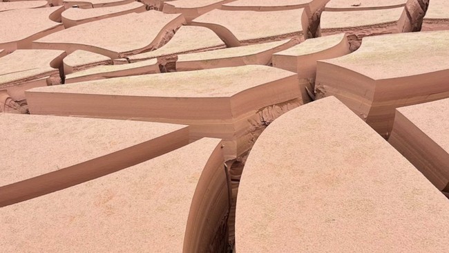
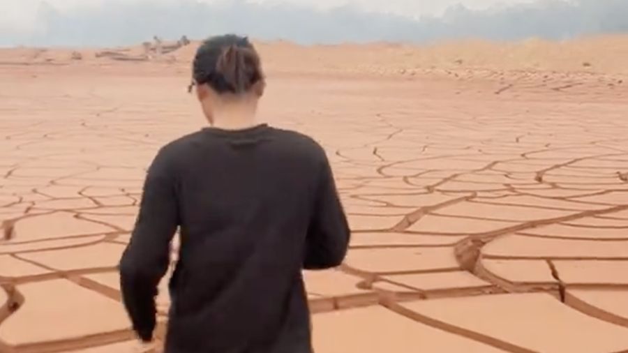
The location at the center of this viral phenomenon is situated in Biku Sarana Village, positioned within the Jelai Hulu administrative district of Ketapang Regency, West Kalimantan Province. Visual evidence captured from the site reveals that a substantial body of water, formed as a consequence of historic or ongoing extraction activities, has suffered severe water recession. The underlying sediment, composed of compacted earth, clay, and mining residues, has dried out completely, resulting in a network of wide, interconnected fissures across the landscape.
Unlike natural lakes or river basins, this waterbody is classified as an anthropogenic void—commonly referred to in environmental studies as a post-mining void or kolong. These artificial basins are created when earth-moving operations dig beneath the local water table, causing water to accumulate once active dewatering operations cease. The recent dry spell caused the water level in this specific Ketapang basin to drop to zero or near-zero levels, exposing the lakebed to direct atmospheric conditions. The rapid evaporation rates, combined with the lack of immediate hydrological recharge, caused the exposed sediment to shrink and crack, creating a texture that netizens have rhetorically compared to arid African landscapes or classic desert dunes.
Chronology of the Viral Phenomenon
The public discovery of the Ketapang "desert" began in late September 2026, when local content creators and travelers documented the unusual topography. The timeline of the event unfolded rapidly across digital networks:
- Initial Emergence and Documentation: Local residents and visitors traveling through Jelai Hulu noted the unusual dryness of the former mining pool. The water, which usually masked the underlying topography of the excavation pit, had completely receded, leaving behind a stark, bleached landscape.
- Social Media Diffusion: Visual content uploaded by TikTok user Tyaaaaaaaaa243 captured the scale of the dry lakebed, showing drone-style or wide-angle ground views of the cracked earth. The videos quickly accumulated hundreds of thousands of views, shares, and comments within a 48-hour window.
- Widespread Comparison and Debate: By September 30, 2026, screenshots and video excerpts circulated widely across other social media platforms, including X (formerly Twitter), Instagram, and Facebook. Commentators debated whether the landscape was a natural geological formation or a consequence of industrial land alteration, prompting a wave of curiosity regarding its precise geographic coordinates.
- Contextualization by Environmental Observers: As the imagery gained traction, environmental observers and regional commentators began contextualizing the visuals, pointing out that the site is an artificial water body resulting from historical extractive industries rather than a natural geological anomaly.
Geographical and Environmental Context
To fully understand the appearance of this dry basin, it is necessary to examine the broader environmental and geographical profile of West Kalimantan. The province is historically characterized by equatorial tropical rainforests, extensive peatlands, and a humid tropical climate featuring high annual precipitation rates. Typically, water availability in regions like Ketapang Regency remains robust due to predictable monsoon cycles and substantial baseline rainfall.
However, artificial bodies of water such as ex-mining pits operate under vastly different hydrological rules compared to natural lakes. Natural lakes are integrated into stable, complex watershed systems with continuous subterranean and surface inflows. Conversely, post-mining voids are often isolated hydrological units with limited natural drainage integration. Their water levels fluctuate dramatically based on localized precipitation and evaporation rates.
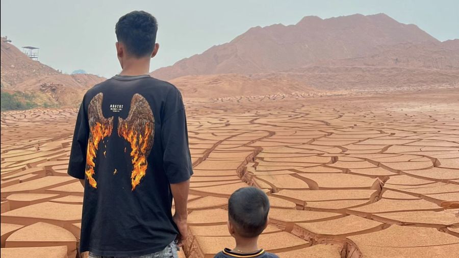
During extended periods of reduced rainfall—often linked to regional climatic anomalies such as El Niño or localized seasonal dry spells—these artificial ponds are acutely vulnerable. Without sufficient recharge from surrounding groundwater aquifers or surface streams, the volume of water stored in these pits diminishes rapidly through evaporation. Once the water column evaporates entirely, the fine-grained sediments deposited at the bottom of the pit are exposed to solar radiation, accelerating the drying process and inducing severe surface cracking.
Scientific and Industrial Implications
The phenomenon in Biku Sarana Village serves as a micro-case study for broader environmental and geological concerns associated with post-mining landscapes across Indonesia. Indonesia’s mineral and coal extraction sectors have left behind thousands of similar voids across islands like Kalimantan, Sumatra, and Bangka Belitung.
From an environmental engineering perspective, the drying of these pits poses several distinct challenges:
- Soil Compaction and Erosion: The severe cracking observed in the Ketapang pit indicates high clay or fine-silt content. When these soils undergo extreme cycles of wetting and drying, their structural integrity degrades, increasing the susceptibility of the surrounding banks to slope failure and erosion when heavy rains finally return.
- Water Quality Shifts: As water levels drop, the concentration of dissolved minerals, heavy metals, and acidic compounds (in cases of acid mine drainage) can increase dramatically in any remaining puddles. While the Ketapang site is currently dry, the residual sediment may contain concentrated mineral residues from past extraction activities.
- Ecosystem Disruption: Although artificial voids are not pristine natural habitats, local fauna and human communities often come to rely on them for various secondary uses, including localized fishing, agricultural irrigation, or livestock watering. The sudden loss of water in these basins temporarily disrupts these secondary socio-ecological functions.
Official Responses and Institutional Perspectives
While direct emergency responses from local disaster management agencies (BPBD) regarding this specific dry lakebed have not indicated an immediate threat to human settlements, regional environmental bureaus frequently monitor post-mining landscapes for long-term ecological risks. Under Indonesian mining regulations, concession holders are legally obligated to execute post-mining reclamation and rehabilitation plans, which include the proper management, stabilization, or backfilling of open excavation voids.
Local authorities in Ketapang Regency and the broader West Kalimantan provincial administration have consistently emphasized the importance of corporate accountability in post-mining land management. Incidents like the one in Jelai Hulu bring renewed attention to the long-term legacy of resource extraction, prompting calls for stricter oversight regarding how abandoned pits are monitored, rehabilitated, or secured once commercial activities cease.
Socio-Economic and Public Reactions
The public reaction to the images from Biku Sarana Village reflects a growing fascination with unusual anthropogenic landscapes. On digital platforms, internet users expressed a mixture of awe and concern. While some marveled at the surreal aesthetic of a "desert" situated in the heart of a traditionally lush tropical province, others raised serious questions regarding the environmental sustainability of unmanaged excavation sites.
Sociologists and media analysts note that viral phenomena of this nature play a dual role in modern public discourse. On one hand, they act as digital tourism catalysts, drawing temporary attention to remote villages. On the other hand, they serve as informal environmental report cards, using visual shock value to communicate complex ecological issues—such as climate stress, water scarcity, and industrial land footprints—to a broad, non-specialist audience.
Broader Impact and Future Outlook
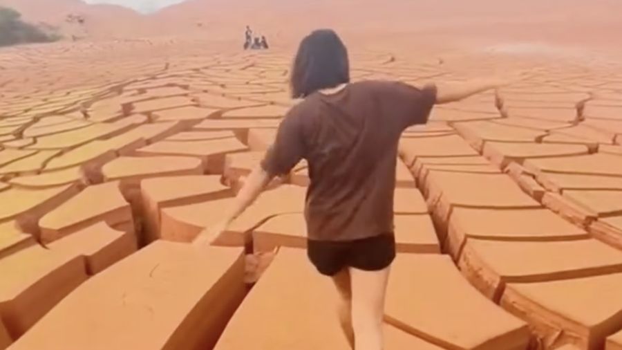
The appearance of the cracked, desert-like terrain in Ketapang Regency is ultimately a transient phenomenon that will likely reverse itself with the onset of the next wet season. When sustained heavy rainfall returns to West Kalimantan, precipitation will once again collect within the topographical depression of the ex-mining pit, submerging the cracked earth and restoring the artificial lake.
However, the cyclical exposure of these lakebeds underscores a permanent reality of post-mining geography: artificial voids remain dynamic, unstable environments sensitive to climatic shifts. As regional weather patterns become increasingly unpredictable due to global climate shifts, the frequency of extreme dry spells and rapid hydrological fluctuations in artificial water bodies may rise.
For policymakers, environmental scientists, and local communities in West Kalimantan, the event in Biku Sarana Village serves as a vivid reminder of the enduring footprint left by resource extraction. Moving forward, managing these landscapes will require proactive intervention, ranging from comprehensive reclamation strategies to enhanced hydrological monitoring, ensuring that post-mining sites do not pose long-term hazards to the surrounding environment or local populations.

