
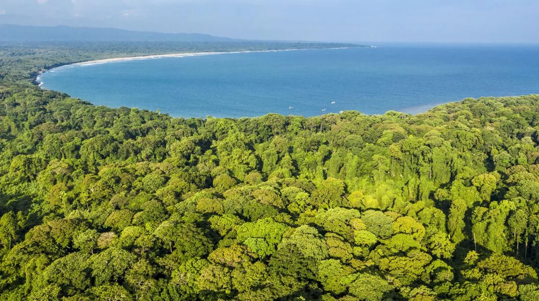
The Ministry of Energy and Mineral Resources (ESDM) has issued a definitive guarantee that no mineral extraction or mining activities will ever be authorized within the ecologically sensitive boundaries of the Ujung Kulon National Park (TNUK) in Banten, Indonesia. This official clarification comes in direct response to mounting public concern and environmental scrutiny regarding the inclusion of specific marine zones surrounding the conservation area into the national Wilayah Usaha Pertambangan (WUP), or Mining Business Areas framework.
The regulatory inclusion stems from Ministerial Decree Number 65.K/MB.01/MEM.B/2026, concerning the Mining Regions of Banten Province, which was formally signed by Minister of ESDM Bahlil Lahadalia on February 12, 2026. The technical designation immediately sparked anxieties among environmental organizations, conservationists, and local communities who feared that the habitats of the critically endangered Javan rhinoceros and other protected endemic species might be compromised by industrial exploitation. However, both central and regional authorities have stepped forward to quell these apprehensions, emphasizing that bureaucratic mapping nomenclature does not equate to operational permits.
Regulatory Safeguards and Spatial Planning Integrity
To understand the legal impossibility of mining in Ujung Kulon, authorities point to the stringent spatial planning frameworks that supersede mineral development policies. Head of the Banten Provincial ESDM Office, Ari James Faraddy, explained that TNUK holds status as a prestigious UNESCO World Heritage Site—a designation bestowed in 1991 in recognition of its extraordinary ecological value and biodiversity. Consequently, the spatial utilization of the park and its surrounding delineated zones is strictly governed by national and regional conservation laws.
According to Banten Provincial Regulation Number 1 of 2023 concerning the Regional Spatial Plan (RTRW) for Banten Province, both the terrestrial and marine territories of the TNUK complex are designated strictly as conservation zones. This legal designation completely prohibits any form of spatial utilization directed toward mining, heavy industry, or commercial exploitation.
"Therefore, based on regional regulatory compliance, we can definitively ensure that there will be no mining activities whatsoever within the Ujung Kulon National Park area," Ari stated during a briefing on Tuesday, November 17, 2026.
Echoing this strict stance, Ministry of ESDM Spokesperson Dwi Anggia reaffirmed that not a single mining license has been issued, nor will be issued, within either the marine waters adjacent to the park or the terrestrial sanctuary itself. Anggia clarified that during the bureaucratic formulation of the WUP, TNUK was explicitly carved out and excluded from any potential industrial exploitation footprints.
"The Ministry of Energy and Mineral Resources emphasizes that the Ujung Kulon National Park area is not designated as a mining region, and up to this moment, not a single mining permit of any kind has been issued, either in the marine waters surrounding Ujung Kulon National Park or within the national park itself," Dwi Anggia stated in an official written release on Wednesday, November 18, 2026.
Understanding the WUP Administrative Framework
To alleviate public confusion, the Ministry of Energy and Mineral Resources detailed the multi-layered regulatory steps required before any extraction can legally occur in Indonesia. The designation of a Wilayah Usaha Pertambangan (WUP) is purely an administrative tool used in national mineral resource planning and macro-level resource governance. It does not, under any legal interpretation, grant an automatic license, concession, or approval to commence physical mining operations.
The statutory hurdles a company must clear before breaking ground are rigorous. First, a geographic space must exist within the overarching WUP framework. However, this is merely the first step. Before any commercial activity can take place, the specific coordinates must transition into a Wilayah Izin Usaha Pertambangan (WIUP)—a designated Mining Business License Area. Even then, a WIUP cannot be claimed arbitrarily; it must be acquired through a competitive public auction mechanism or priority allocation channels strictly regulated by law.
Once a business entity successfully secures a WIUP, it is still prohibited from mining. The enterprise must apply for and be granted a formal Mining Business License (IUP). Anggia emphasized that the issuance of an IUP must meticulously satisfy all statutory mandates outlined in Law Number 4 of 2009 concerning Mineral and Coal Mining, as amended by Law Number 2 of 2025.
These statutory requirements dictate complete harmonization with regional spatial planning maps, the acquisition of a Marine Space Utilization Activity Suitability Approval (PKKPRL) if operations touch coastal or marine zones, and the mandatory approval of a comprehensive environmental impact assessment (AMDAL). The Ministry of Energy and Mineral Resources maintains that its overarching mandate is to balance national economic resource utilization with uncompromising environmental stewardship and conservation protections.
"It must be understood that the establishment of a mining business area does not alter the functional designation of conservation zones nor does it diminish the protective statutory functions of Ujung Kulon National Park," Anggia underscored.
Chronology and Historical Origins of the WUP Designation
The inclusion of marine waters near Ujung Kulon in the 2026 ministerial decree is not a newly conceived policy, but rather a continuation of administrative boundaries that have evolved over more than a decade of bureaucratic planning.
Tracing the historical timeline reveals that the process originated in 2013, when the Provincial Government of Banten submitted a formal proposal for regional mining zoning, which incorporated various marine business areas across Banten’s coastal waters. During that initial phase, authorities explicitly carved out and excluded marine waters overlapping with sensitive conservation boundaries in subsequent iterations, such as Ministry of ESDM Decree Number 1204 of 2014.
The administrative evolution continued on November 16, 2015, when the Banten Provincial Mining and Energy Office issued official letter number 540/763-Distamben/2015. This communication requested the reintegration of specific regional marine data blocks, inadvertently pulling segments of the waters surrounding TNUK back into the broader administrative mapping framework.
This regional submission was subsequently codified under Ministry of ESDM Decree Number 3672 of 2017 concerning the Establishment of Mining Regions for the Islands of Java and Bali. The framework was later reaffirmed through Ministry of ESDM Decree Number 84.K/MB.01/MEM.B/2022 regarding the Mining Regions of Banten Province.
Consequently, Ministry of ESDM Decree Number 65.K of 2026 does not represent a sudden policy shift or a new encroachment on protected habitats. Instead, it serves as an administrative update that carries forward historical regional proposals while recalibrating technical administrative boundaries to align with updated regional governance standards.
Broader Implications and Environmental Sentiments
The controversy highlights the growing sensitivity surrounding environmental governance in Indonesia, particularly regarding protected zones and habitats of globally significant biodiversity. Ujung Kulon National Park spans roughly 78,525 hectares of land and 44,337 hectares of marine environments, serving as the last remaining wild stronghold for the Javan rhinoceros (Rhinoceros sondaicus). With fewer than 80 individuals estimated to remain in the wild, any perceived administrative overlap between industrial zones and conservation territory naturally triggers swift public pushback.
Civil society organizations and environmental watchdogs have increasingly scrutinized bureaucratic mapping procedures, fearing that maps drawn for administrative completeness could later be exploited through regulatory loopholes or future administrative adjustments. By issuing swift, coordinated clarifications from both the central ministry and provincial environmental heads, the government aims to rebuild public trust and reaffirm that conservation priorities remain legally absolute.
Legal experts note that while administrative overlapping in macro-spatial planning documents is a common artifact of bureaucratic synchronization between regional governments and central ministries, robust multi-tiered statutory protections—such as forestry laws, environmental protection acts, and spatial planning regulations—provide an effective firewall. As long as regional spatial plans (RTRW) explicitly prohibit industrial extraction in conservation zones, obtaining operational permits remains a legal impossibility.
Moving forward, the Ministry of Energy and Mineral Resources has pledged greater transparency in coordinating spatial data layers between the energy sector and environmental authorities, ensuring that future administrative decrees eliminate ambiguities that could cause public anxiety or compromise Indonesia’s steadfast commitment to global conservation agreements.

