
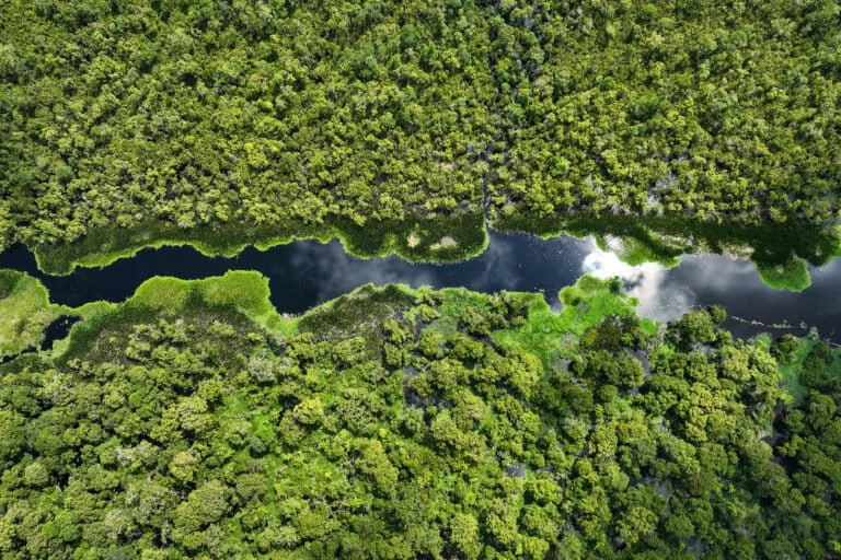
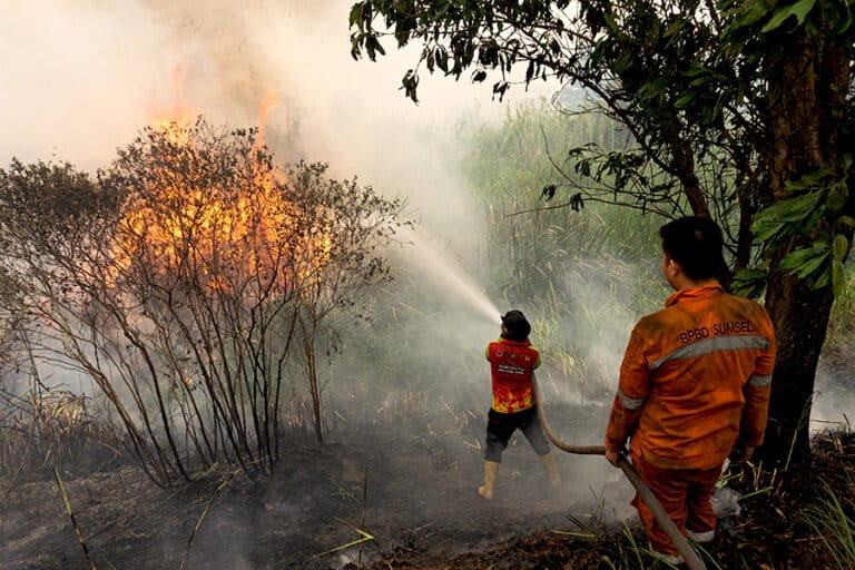
Indonesia is bracing for a significantly heightened risk of forest and land fires as the nation enters a prolonged dry season, exacerbated by a severe El Niño weather pattern predicted to extend well into the latter half of the year. The Ministry of Environment and the newly established Environmental Management Agency (KLH/BPLH) have issued an urgent directive to all land concession holders, mandating a rigorous intensification of fire mitigation strategies. The primary focus of this national effort is the large-scale "rewetting" of peatland ecosystems, a critical intervention designed to maintain soil moisture and prevent the emergence of volatile hotspots. With the government setting an ambitious target of "zero fires" within corporate concessions, the stakes for both environmental preservation and national health have never been higher.
Peatlands represent one of Indonesia’s most challenging yet vital landscapes. Unlike mineral soils, peat is composed of layers of partially decomposed organic matter that, when dry, becomes highly flammable and capable of smoldering underground for weeks. Jumhur Hidayat, the Minister of Environment and Head of BPLH, emphasized during a high-level working meeting in Jakarta on Friday, July 10, 2026, that the management of peatlands is not merely a matter of preventing smoke and haze. It is fundamentally about the protection of an ecosystem that provides indispensable services, most notably its capacity to sequester carbon at rates significantly higher than traditional tropical forests. Minister Hidayat asserted that the strategy must move beyond reactive firefighting toward proactive ecological preservation, ensuring that peat remains saturated to safeguard its role as a global carbon sink.
Strategic Mitigation and the Hydrology of Peatlands
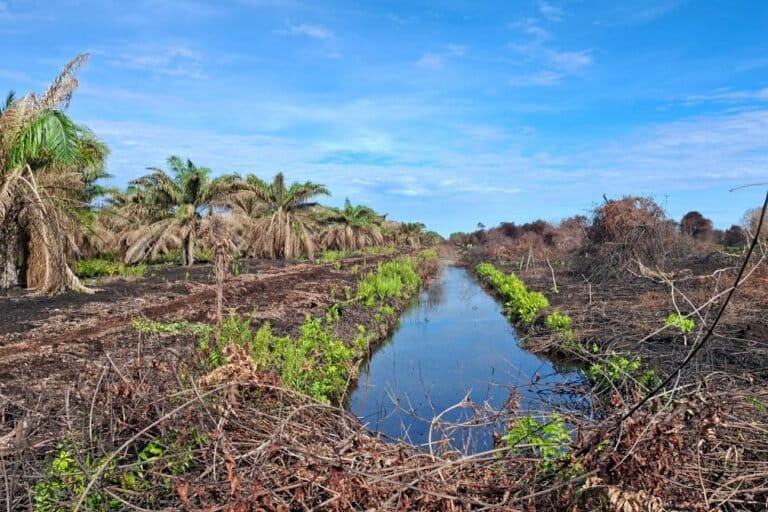
The government’s mitigation framework rests heavily on sophisticated water management systems. To prevent peat from drying out to its deeper, more combustible layers, companies are now legally required to implement "canal blocking" (sekat kanal). This infrastructure is designed to halt the drainage of water from the peat dome into rivers, instead forcing the water to remain within the concession areas to maintain high groundwater levels. Additionally, the construction of "embung" or retention basins is being accelerated to serve as strategic water reserves for emergency suppression.
According to KLH/BPLH records, the scale of this infrastructure is already vast. Currently, across 4.15 million hectares of peatland managed by 314 different companies, a total of 34,989 canal blocks have been constructed. Outside of corporate concessions—within community lands, state forest areas, and buffer zones—another 8,857 canal blocks are operational. However, the government estimates that an additional 17,394 units are still required to achieve a comprehensive hydrological balance across the archipelago’s most vulnerable peat landscapes. The goal is to ensure that no part of the peat ecosystem reaches a state of "critical dryness," where it effectively transforms into a massive, subterranean fuel source.
The 80-Centimeter Threshold: A Critical Indicator of Danger
Sigit Reliantoro, the Deputy for Environmental Governance and Sustainable Natural Resources at KLH/BPLH, provided a technical breakdown of the current crisis. He noted a drastic decline in the Groundwater Table (TMAT) since the beginning of 2026, a trend that accelerated sharply as the country entered July. This decline has triggered a significant spike in hotspots across several fire-prone provinces. The TMAT level is the most reliable indicator of peat vulnerability; when the water table drops too low, the peat loses its moisture and becomes a tinderbox.
"A groundwater level below 80 centimeters is considered extremely dangerous," Reliantoro explained. "Once the water table reaches that depth, the peat functions as an active fuel that will almost inevitably lead to ground fires." The government’s current risk analysis methodology integrates real-time data from approximately 10,000 TMAT monitoring points with satellite-detected hotspot distributions. When a drop in the water table coincides with the appearance of a hotspot, the area is immediately reclassified as a "very high-risk zone," triggering immediate mobilization of fire suppression teams and rewetting efforts.
Regional Hotspots and Critical Zones: A 2026 Status Report
As of early July 2026, the hydrological condition of several key regions has reached an alarming status. Sumatra, in particular, is facing a critical situation. Riau and South Sumatra have been placed under "high alert" status due to the convergence of low TMAT levels and a high frequency of medium-to-high confidence hotspots.
In Riau, the government has identified 80 "vulnerable" TMAT points and one "highly vulnerable" point. Between January and July, the province has seen a steady rise in risk, with the Pelalawan, Indragiri Hilir, Bengkalis, Dumai, and Rokan Hilir districts identified as high-priority areas. Pelalawan is currently the most at-risk district in Riau, recording 13 highly vulnerable TMAT points. Meanwhile, South Sumatra is struggling with 28 vulnerable TMAT points and 52 medium-level hotspots, with Ogan Komering Ilir (OKI) remaining the primary focus for emergency interventions.
The situation in Kalimantan is equally dire. West Kalimantan has been designated a high-risk province, specifically in the Kubu Raya district, which recorded 1,823 peat hotspots between January and June 2026. In the Landak and Bengkayang districts, the average groundwater level has plummeted to minus 85 centimeters, well beyond the safety threshold. Central and South Kalimantan are also under high alert, with 82 hotspots detected as of July 8, including several high-confidence fires in Sukamara, Katingan, and Lamandau.
The Challenge of Monitoring "Blank Spots"
Despite the technological advancements in monitoring, a significant obstacle remains: the "blank spot" phenomenon. Sigit Reliantoro revealed that while there are thousands of villages located within peat ecosystems, only a small fraction are equipped with TMAT monitoring systems. This lack of data creates dangerous blind spots for disaster management agencies.
In Jambi, for instance, only 51 out of 154 peat villages have monitoring equipment. The gap is even wider in Riau, where 512 out of 670 peat villages remain unmonitored. The most severe monitoring deficits are found in Kalimantan; in West Kalimantan, 295 out of 366 peat villages lack TMAT sensors, and in Central Kalimantan, only 50 out of 304 villages are integrated into the national monitoring system. To bridge this gap, the government is pressuring the private sector to expand their monitoring networks and take responsibility for the rewetting of surrounding community lands through "water sharing" initiatives.
Law Enforcement and Corporate Accountability
The Ministry is also taking a hardline stance on legal accountability. Irjen Pol Rizal Irawan, Deputy for Environmental Law Enforcement (Gakkum), stated that the government would not hesitate to impose severe sanctions on companies that fail to prevent fires within their concessions. Under current Indonesian law, companies found responsible for forest fires can face a combination of administrative, civil, and criminal penalties.
"Administrative fines can range from tens to hundreds of billions of rupiah, depending on the extent of the damage," Rizal said. He noted that in 2025, civil lawsuits against companies for fire-related damages resulted in more than IDR 500 billion in fines that have already reached final legal standing (inkrah). For 2026, the Ministry is already processing civil cases against four major companies, signaling that the era of impunity for corporate-led environmental degradation is coming to an end.
Corporate Claims and Environmental Realities
Several major industry players, including PT Arara Abadi (Sinarmas Group), PT TH Indo Plantation (THIP), and the state-owned Pertamina Patra Niaga, have publicly claimed to be in full compliance with the government’s rewetting mandates. Pertamina highlighted its "Gambut Lestari" (Sustainable Peat) program, which utilizes innovative fire suppression nozzles and portable hydrants. Arara Abadi and THIP have touted their "water sharing" systems, which use gravity and axial pumps to move water from higher-elevation concessions to lower-lying community lands.
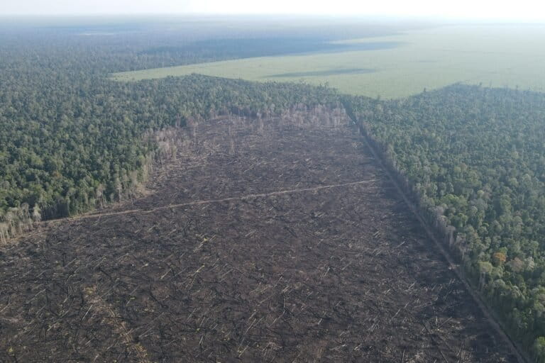
However, these corporate narratives are met with skepticism by environmental advocacy groups. Organizations like Pantau Gambut and Walhi point out that both Arara Abadi and THIP have long histories of recurring fires within their concessions. Field investigations by Mongabay Indonesia in 2026 confirmed that fires continue to break out within APP-linked concessions despite the presence of canal blocks.
Wahyu Perdana, Manager of Advocacy and Communications at Pantau Gambut, argued that the success of restoration cannot be measured solely by the number of canal blocks built. "A canal block is just a tool, not the end goal," Perdana stated. He noted that a recent study by his organization found that 70% of monitored canal blocks were in a state of disrepair—often built with perishable materials like wood and bamboo—and 52% of intervention sites still showed groundwater levels below the safety threshold.
The Changing Landscape: From Forest to Monoculture
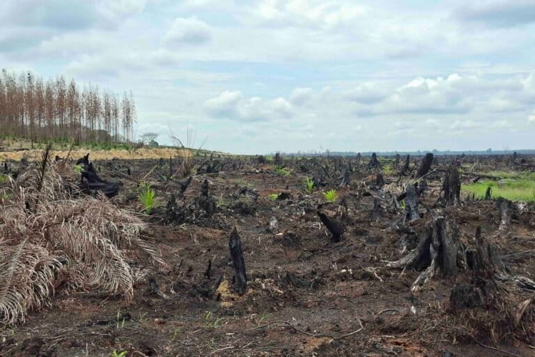
The implications of these recurring fires are profound. Data from Pantau Gambut suggests that between 2015 and 2019, only 1% to 3% of burned peatlands successfully reverted to natural forest. Instead, 54% of these areas were converted into monoculture plantations, primarily oil palm, while 41% turned into degraded scrubland. This shift represents a permanent loss of biodiversity and a massive release of stored carbon into the atmosphere.
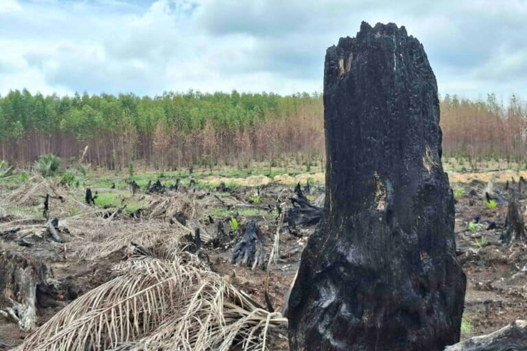
Furthermore, the fire crisis is expanding into new frontiers. In Papua, particularly in the South Papua province, the government’s "Food Estate" and other National Strategic Projects (PSN) are increasingly linked to rising hotspot counts. Walhi’s analysis showed that nearly a third of all hotspots in South Papua in early July 2026 occurred within areas earmarked for large-scale agricultural or energy intervention. Uli Arta Siagian of Walhi warned that these fires should not be viewed as natural disasters but as a direct consequence of massive land-use changes that strip the landscape of its natural ability to retain water.
As the 2026 El Niño continues to intensify, the battle for Indonesia’s peatlands has reached a tipping point. The government’s "zero fire" ambition will require more than just administrative compliance; it demands a fundamental shift in how peatland ecosystems are valued and managed. Without rigorous infrastructure maintenance, genuine community empowerment, and uncompromising law enforcement, the cycle of fire and haze is set to remain a tragic fixture of the Indonesian dry season.

