
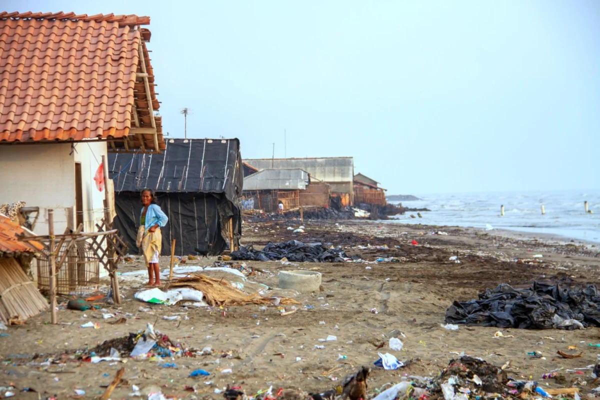
The Northern Coast of Java, colloquially known as the Pantura, is currently undergoing a period of rapid and systemic environmental degradation that threatens the socio-economic stability of Indonesia’s most populous island. According to recent data released by the National Research and Innovation Agency (BRIN), approximately 65.8 percent of the coastline stretching from Serang Regency in Banten to Situbondo Regency in East Java is being consumed by erosion. This phenomenon is not merely a localized issue but a massive regional shift that highlights the vulnerability of Indonesia’s coastal infrastructure and the urgent need for a paradigm shift in maritime and land management.
The Geological Roots of Vulnerability
The severity of the erosion in the Pantura region is deeply rooted in its geological composition. Tubagus Solihuddin, a senior researcher at BRIN’s Climate and Atmosphere Research Center, notes that a significant portion of the Northern Java coastline is composed of pluvial and deltaic deposits. From a geological perspective, these sediments are classified as "unconsolidated," meaning they have not yet fused into solid rock. This lack of structural integrity makes the shoreline highly susceptible to the kinetic energy of ocean waves and the shifting tides.
Compounding this geological fragility is the region’s low-lying morphology. Much of the Pantura is characterized by low relief and flat plains, with elevations frequently measuring less than ten meters above sea level. While erosion dominates the landscape, the process of accretion—the accumulation of new land through sediment deposits—is occurring at a rate of 34.2 percent. However, this accretion is often inconsistent and does not compensate for the loss of habitable and productive land.
The research indicates that even natural delta systems, which should theoretically serve as centers of sedimentation, are now experiencing net erosion. This reversal is largely attributed to human intervention in upstream river systems. The construction of dams, the diversion of river channels, and the "canalization" of natural waterways have effectively choked the supply of sediment to river mouths. Without this steady influx of silt and mud, the deltas cannot rebuild themselves, leaving them defenseless against the encroaching Java Sea.
The Dual Threat: Sea Level Rise and Land Subsidence
The environmental crisis in Northern Java is defined by a "double whammy" of rising seas and sinking land. Scientific monitoring shows that the average rate of Sea Level Rise (SLR) along the Pantura is between 0.41 and 0.42 centimeters per year. While these numbers may seem small in isolation, the cumulative impact is devastating. Projections for the period between 1993 and 2025 suggest a total rise of 15.5 centimeters, a threshold that significantly alters the reach of tidal floods and storm surges.
However, the most immediate threat is not the rising water, but the sinking land. Land subsidence in the Pantura is occurring at rates that far outpace the global average of sea level rise. In Demak, Central Java, the land is sinking by as much as 16 centimeters per year—the highest rate recorded in the region. This is closely followed by Jakarta at 15 centimeters per year and Sidoarjo at 14 centimeters per year.
Agung Syetiawan, a researcher at BRIN’s Geoinformatics Research Center, identifies the primary driver of this subsidence as the massive and unregulated exploitation of groundwater. As the demand for clean water increases due to population growth and the expansion of industrial aquaculture (fishponds), the pressure on underground aquifers has reached a breaking point. When water is extracted from these deep layers faster than it can be replenished, the overlying soil layers compact and collapse, causing the surface to sink.
Chronology of Encroachment and Infrastructure Loss
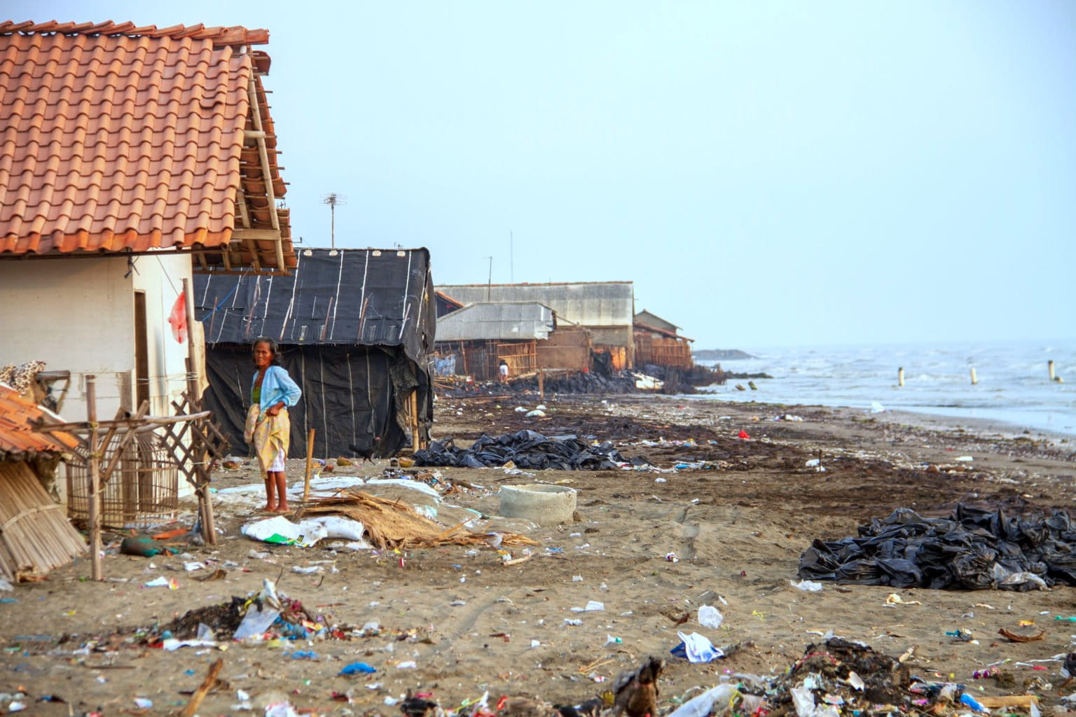
The timeline of this degradation has moved from seasonal flooding to permanent inundation in several key districts. In Muara Gembong, Bekasi Regency, the sea has advanced up to four kilometers inland. This is not a temporary flood; it is a permanent loss of territory. In Pantai Bahagia, the erosion has effectively erased public infrastructure, including schools and roads, and submerged more than 1,000 hectares of productive fishponds, destroying the primary source of income for thousands of families.
Similar patterns are emerging in other hotspots:
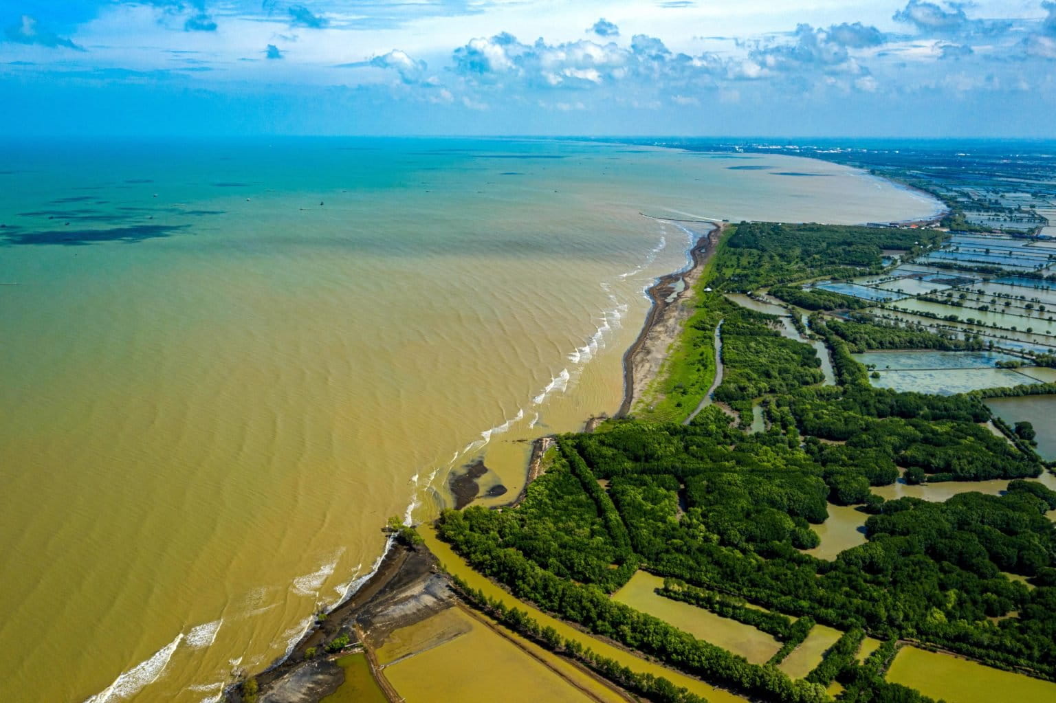
- Tanjung Pontang, Serang: Seawater intrusion has pushed five kilometers into former agricultural zones.
- Legonkulon, Subang: Coastal erosion is rapidly consuming rice fields that were once the "rice bowl" of West Java.
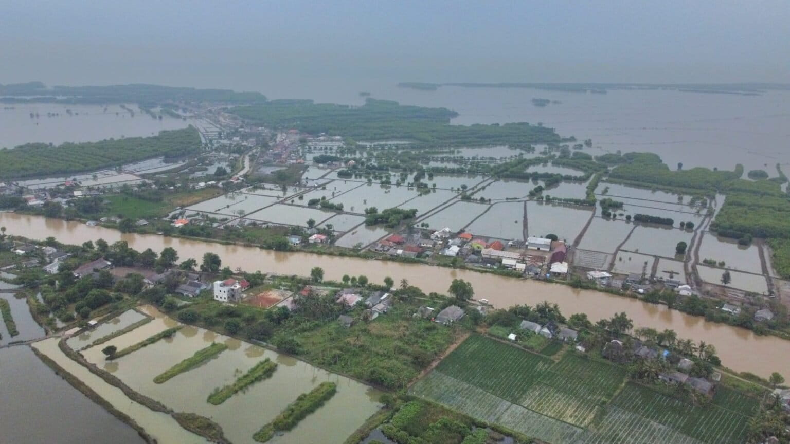
- Demak, Central Java: Entire villages have been abandoned as the sea now reaches up to six kilometers inland, turning former neighborhoods into ghost towns of half-submerged houses.
The speed of this transition has caught many local governments off guard. What were once considered "100-year flood events" are now occurring monthly during high tides, leading to a state of perpetual crisis for coastal residents.
The Collapse of the Mangrove Buffer
Ecologically, the Pantura was once protected by a thick belt of mangrove forests. These ecosystems served as natural wave breakers and sediment traps. However, Frida Sidik, an expert in mangrove ecology from BRIN, warns that the very factors destroying the coast are also killing the mangroves.
"When erosion occurs and the existing coastline is disrupted, mangroves are the first to suffer," Sidik explains. Mangroves are highly sensitive to their environment; they require a specific balance of sediment and water depth. As the land sinks and the sea rises, the mangroves are essentially "drowned" or uprooted by high-energy waves that they can no longer withstand.
Furthermore, the loss of upstream sediment supply means that mangroves do not have the mud they need to survive. There is a common misconception that simply planting new seedlings can solve the problem. Sidik stresses that restoration is not a universal solution. Each coastal segment has a unique morphology; a mangrove species that thrives in one area may be completely swept away in another. Without a stable substrate and proper hydrological conditions, reforestation efforts are often futile, leading to a waste of resources and a false sense of security.
Mapping the Geological Diversity of the Northern Coast
To understand why some areas fail while others persist, one must look at the 1,668.7-kilometer stretch of the Pantura through a geological lens. According to a 2026 study titled Coastal dynamics along the Northern Coast of Java, Indonesia: Scales, impacts, and governance strategies, the coastline is a mosaic of different environments:
- Muddy/Mangrove Coasts: These cover 949.2 km (47.8%) and are the most vulnerable to subsidence and erosion.
- Sandy Coasts: Spanning 501.6 km (25.3%), these areas face different erosion patterns driven by longshore currents.
- Rocky Coasts: Representing only 1% (19.8 km), these are the most stable but are rare in the region.
- Modified Coasts: Approximately 513.4 km (25.9%) of the coast has been "hardened" with sea walls, ports, breakwaters, and groins.
The study notes that "hard" engineering solutions, such as concrete sea walls, often exacerbate erosion in neighboring areas by disrupting the natural flow of sediment. This "neighbor-beggar" effect means that protecting a port in Cirebon or Semarang might inadvertently lead to the disappearance of a beach or a mangrove forest a few miles down the coast.
Socio-Economic Implications and Policy Requirements
The implications of a sinking Pantura extend far beyond environmental loss; they threaten the national economy. The Pantura highway is the primary artery for logistics on Java Island. As the land sinks, this vital infrastructure is increasingly threatened by tidal flooding (rob), leading to massive delays and increased maintenance costs.
M. Rokhis Khomarudin, Head of BRIN’s Geoinformatics Research Center, emphasizes that the solution must be systemic. "We cannot rely on a single solution because every beach has a different character," he stated. The current approach, which often involves reactive construction of dikes after a flood occurs, is insufficient.
A comprehensive strategy for the Pantura must include:
- Groundwater Regulation: Strict enforcement of bans on deep-well drilling in high-subsidence zones, coupled with the development of alternative piped water sources.
- Geospatial Planning: Using high-resolution satellite data to map subsidence in real-time, allowing for "preventative" rather than "reactive" engineering.
- Sediment Management: Re-evaluating upstream dam operations to allow for "sediment flushing" that can replenish downstream deltas.
- Ecological Buffers: Moving away from purely "hard" infrastructure to "hybrid" solutions that combine sea walls with rehabilitated mangrove zones.
- Relocation and Adaptation: Acknowledging that some areas may be beyond saving, requiring a managed retreat and the relocation of vulnerable communities to higher ground.
Conclusion
The degradation of the Northern Coast of Java is a stark reminder of the limits of human intervention in natural systems. The combination of geological fragility, climate change, and aggressive resource extraction has created a crisis that cannot be solved by concrete alone. As the sea continues its four-kilometer-deep march into the heart of Java’s coastal regencies, the window for scientific and policy-driven intervention is closing. The future of the Pantura depends on the ability of the Indonesian government to balance economic ambition with the unforgiving reality of a changing coastline. Without a holistic, data-driven approach that respects the dynamic nature of the Java Sea, the "sinking" of the Pantura may become a permanent fixture of Indonesia’s geography.

